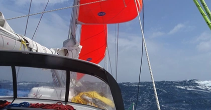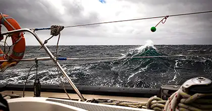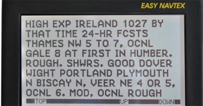


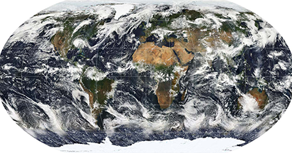
An air mass is a large volume of air in the atmosphere that is mostly uniform in temperature and moisture. These air masses can extend thousands of kilometers in any direction and reach from ground level to the stratosphere – up to 16 kilometers (10 miles) into the atmosphere. Understanding air masses is crucial for meteorology, particularly for mariners who rely on accurate weather predictions to ensure safe and efficient voyages.
Formation & Movement of Air Masses
Air masses form over large surfaces with uniform temperatures and humidity, called source regions. These regions are typically stable areas with low wind speeds, allowing the air to remain stationary long enough to adopt the properties of the surface below. For example, air masses can form over oceans, deserts, or polar ice caps.
As the air masses move, driven by prevailing winds and pressure systems, they carry their weather conditions – such as heat or cold, dryness or moisture – from their source regions to new areas. This movement can lead to significant weather changes in the regions they traverse.
Classification of Air Masses
Meteorologists classify air masses based on their temperature, moisture content, and source regions:
- Temperature:
- Arctic (A): Extremely cold, an arctic air mass unsurprisingly originates from the Arctic region.
- Polar (P): Cold air mass from high-latitude regions.
- Tropical (T): Warm air mass from low-latitude areas.
- Equatorial (E): Very warm air mass from near the Equator.
- Moisture:
- Continental (c): Continental air masses are a dry air mass, forming over land.
- Maritime (m): Maritime air masses are moist and form over oceans.
- Additional Classifications:
- Monsoon (M): Air mass characterized by seasonal wind changes, often bringing heavy rains.
- Superior (S): Dry air mass formed by powerful downward atmospheric motions.
Air masses are identified on weather maps using a combination of letters that describe their properties:
- Moisture: ‘m’ for maritime (moist), ‘c’ for continental (dry).
- Heat: ‘E’ for equatorial, ‘T’ for tropical, ‘M’ for monsoon, ‘P’ for polar, ‘A’ for Arctic or Antarctic, ‘S’ for superior.
- Ground Relationship: ‘k’ for colder than the ground below, ‘w’ for warmer than the ground.
Examples of Air Masses
- Continental Polar (cP): Cold and dry, continental polar air masses form over high-latitude land areas such as northern Canada and Siberia.
- Maritime Polar (mP): Cold and moist air mass developing over cold ocean waters in high latitudes, such as the North Atlantic and North Pacific.
- Continental Tropical (cT): Warm and dry, continental tropical air masses form over hot, dry desert regions like the southwestern United States or the Sahara Desert.
- Maritime Tropical (mT): Warm and moist, a maritime tropical air mass originates over warm ocean waters in low latitudes, such as the Gulf of Mexico or the Caribbean Sea. It’s the hazy, hot, and humid air mass!
Movement and Modification of Air Masses
Air masses move primarily due to the influence of prevailing winds and the jet stream. The Coriolis effect, resulting from the Earth’s rotation, also causes the deflection of moving air masses to the right in the Northern Hemisphere and to the left in the Southern Hemisphere.
As air masses travel, they often undergo modifications due to interactions with other air masses and changes in the underlying surface. These modifications can lead to various weather phenomena:
- Temperature Changes: Air masses bring temperature changes as they move into new regions. For example, a cold air mass moving into a warm area can cause a significant drop in temperature.
- Precipitation: When air masses with different properties meet, they create fronts that can lead to cloud formation and precipitation. For instance, maritime tropical air masses rising over a mountain can cool and lose moisture, leading to rainfall.
- Wind Patterns: The movement and interaction of air masses influence local and regional wind patterns. The meeting of cold and warm air masses can result in strong winds and storm systems.
- Sometimes, air masses come into serious conflict with each other. Imagine a cold, dry continental polar air mass that heads south from Canada and comes up against a maritime tropical air mass. There’s going to be trouble: think big winter storms and blizzards.
Stability and Instability
An air mass is considered stable when the temperature decreases slowly with height or when there is a temperature inversion (warmer air above cooler air, such as with a continental polar air mass). This inhibits vertical motion and tends to produce calm and clear weather conditions.
An air mass becomes unstable when the temperature decreases rapidly with height, such as with equatorial air masses, encouraging vertical motion. This often leads to the development of clouds, precipitation, and storms.
Causes of Instability in Air Masses
- Differential Heating:
- When an air mass moves over a surface with varying temperatures, it can cause differential heating within the air mass. For instance, when a maritime tropical air mass moves over a hot land surface, the lower layers of the air mass can warm up more quickly than the upper layers, creating instability.
- Geographic Features:
- Topography: Mountains and hills can force an air mass to rise. As the air ascends, it cools and can reach the dew point, causing condensation and cloud formation, which can destabilize the air mass. On the leeward side of mountains, the descending air can become warmer and drier, further contributing to instability.
- Bodies of Water: Moving over warm or cold bodies of water can modify the temperature and moisture content of warmer air masses. For example, a cold air mass moving over a warm ocean can pick up moisture and become more unstable.
- Convection:
- Surface Heating: Intense heating of the Earth’s surface, such as during the daytime in tropical regions, can cause the lower layers of an air mass to warm up rapidly. This heating causes the air to rise and cool, potentially leading to convection and thunderstorm development.
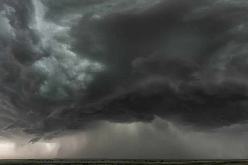
- Cold Fronts: When a cold front forces warm air to rise rapidly, it can lead to significant convection and instability, often resulting in severe weather such as thunderstorms and tornadoes.
- Advection:
- Warm Advection: When warm air is advected (transported horizontally) over a cooler surface, it can lead to the cooling of the lower layers of the air mass, creating a temperature inversion and instability.
- Cold Advection: Conversely, when cold air is advected over a warmer surface, it can lead to the warming of the lower layers and rising of the air, causing instability. This can happen when arctic air masses are warmed by land during the day.
- Atmospheric Disturbances:
- Jet Streams and Upper-Level Troughs: Strong winds in the upper atmosphere, such as jet streams, can create divergence aloft. This divergence causes air at the surface to rise and can enhance instability in the lower atmosphere.
- Cyclones and Fronts: Low-pressure systems and frontal boundaries can force air masses to lift, enhancing instability. The interaction between different air masses at fronts can lead to significant weather events.
Conclusion
Understanding what it is and how an air mass forms is essential for sailors and meteorologists alike. By recognizing the formation, classification, and movement of air masses, one can better predict weather conditions and make informed decisions for navigation and safety. This comprehensive knowledge equips sailors with the tools needed to anticipate and interpret weather changes, ensuring safer and more efficient voyages on the open sea.